CCAPS Launches New Mapping Tool
3 Apr 2012
Our partners at the Robert S. Strauss Center’s external pageClimate Change and African Political Stabilitycall_made (CCAPS) program have recently launched a external pagepilot versioncall_made of a mapping tool that analyzes intersections between climate change, conflict and aid.
The mapping tool is the result of CCAPS’ partnership with external pageAidDatacall_made, and offers researchers and policymakers the opportunity to visualize the intersection of these issues within Africa. Arguably its key strength is its ability to select and layer multiple sources of CCAPS data onto one map of Africa to assess “how myriad climate change impacts and responses intersect”.
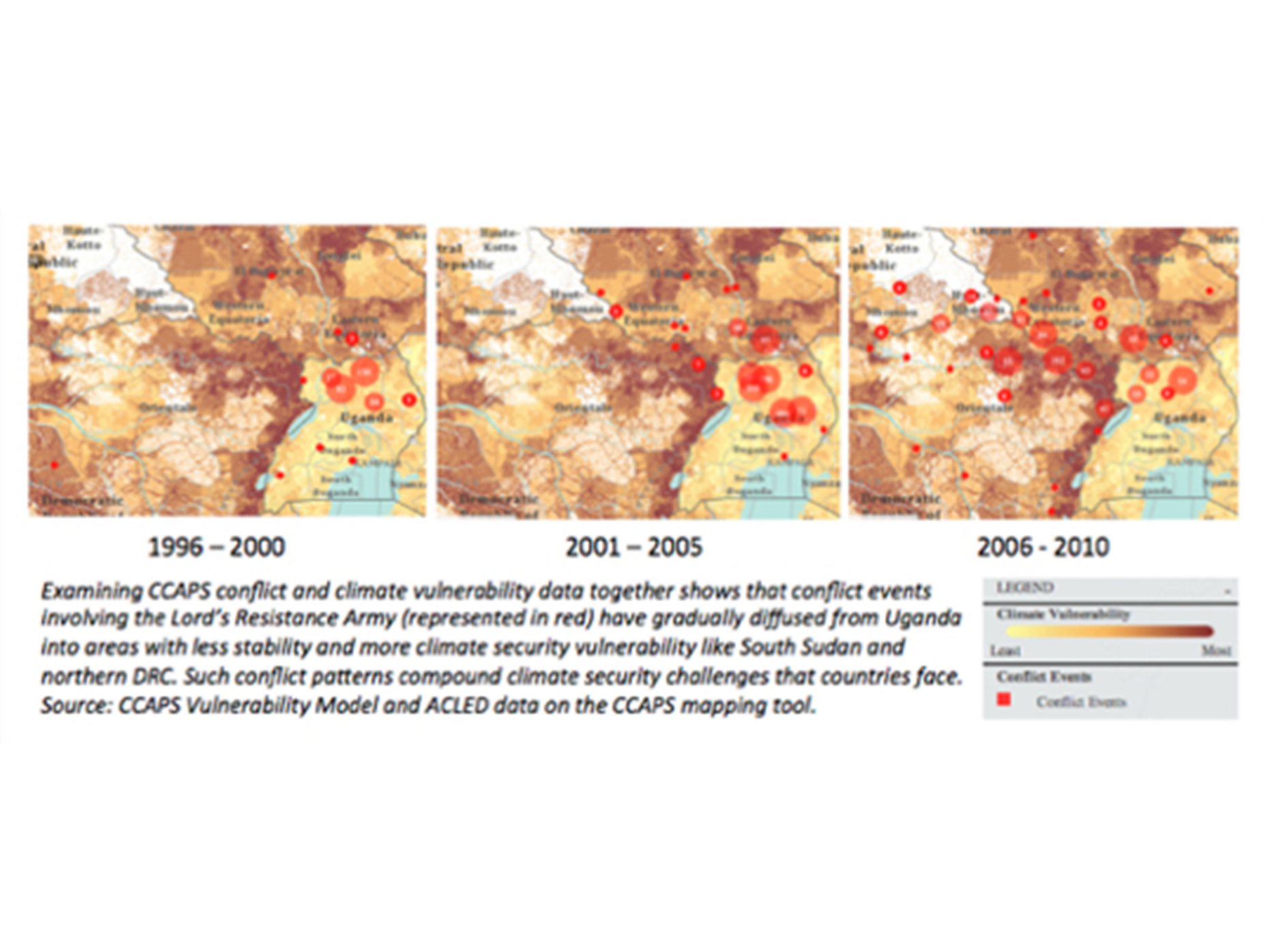
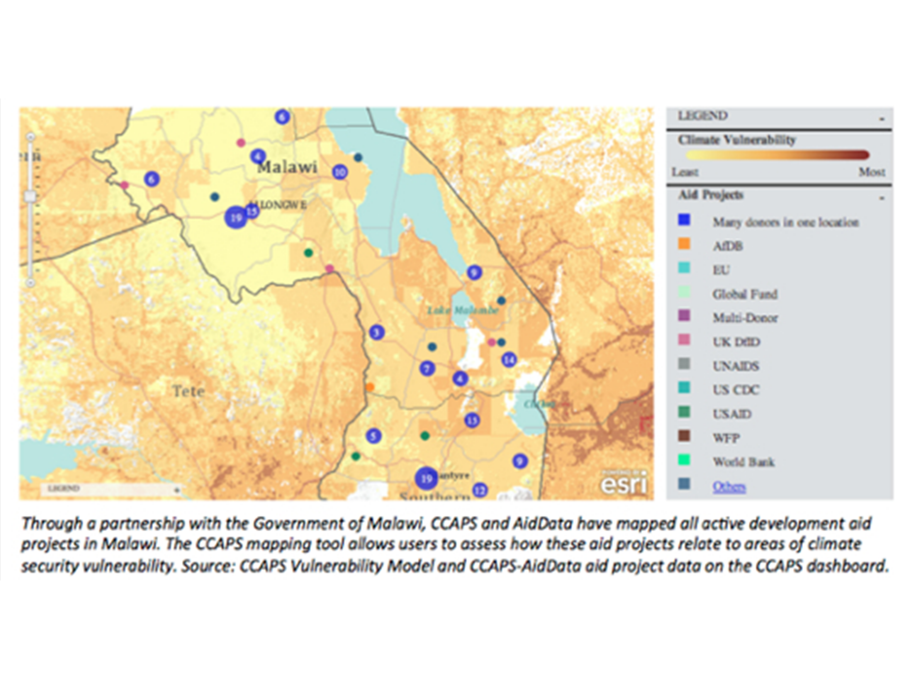
The following screenshots highlight what CCAPS’ new mapping tool is capable of generating:
How do conflict trends and chronic climate insecurity intersect in Central Africa?
Is development aid targeting areas with climate security risks?

.jpg)

