The Security Implications of New Mapping Technologies
8 May 2015
By Jordan Branch for ISN
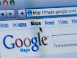
Ten years ago, Google external pageentered the online maps business and revolutionized our ability to navigate daily life. Thanks to the ubiquity of digital mapping, we may never get lost again. Google and its competitors have become the primary source for spatial information in everyday life, providing online maps, directions, and even turn-by-turn navigation on smartphones. Yet the effects of these tools go far beyond simply making travel easier: online mapping is reshaping everything from disaster relief to international boundary disputes. With the possibility for nearly anyone to create a map for almost any purpose, international political interactions are being transformed. Just as mapping helped to establish the territorial state as the dominant political unit in the modern world, new mapping tools and practices could be redistributing power in significant ways.
The cartographic state
Digital mapping tools have been applied to resolving political conflicts for at least two decades. At the 1995 Dayton negotiations, for example, computer mapping systems proved essential to drawing new boundaries and ending the Bosnian war, external pageaccording to U.S. negotiators. The ability to show detailed, three-dimensional terrain and satellite imagery allowed U.S. general Wesley Clarke to external pageconvince Milosevic of the need for a defensible corridor to the Muslim enclave town of Gorazde. Since 2005, far more advanced tools have been available to the public, for free -- yet this has not always encouraged peace. In 2010, as part of an ongoing border dispute between Nicaragua and Costa Rica, a Nicaraguan official referred to the depiction of the boundary on Google Maps to external pagesupport his country’s claim and justify the movement of troops across the border. Google conferred with their source for boundary data -- in this case, the U.S. State Department -- and quickly external pageadjusted their map to match the widely recognized Costa Rican claim. But the damage in this case had already been done, and conflicts over territory will only get more complex as the perceived authority of sources like Google continues to increase.
Traditional paper maps have shaped territorial conflicts and their resolutions for centuries. In the peace negotiations after World War I, for example, external pageextensively researched maps of ethnic and linguistic groups were applied to Wilson’s aspiration of allowing self-determination for the peoples of Central and Eastern Europe. Yet this was not an easy or straightforward task: particularly in the Balkans, ethnic and racial divisions were external pagedifficult to map, and the history of conflict in the region has continued to testify to those challenges. During the same period in the Middle East, negotiators with very different goals used maps of oil resources and strategic interests toexternal pagedraw political boundaries, including divisions like the Sykes-Picot line recently external page“erased” by ISIS.
If we look at an earlier revolution in cartographic technology, however, an even more dramatic effect of mapping appears. Until five hundred years ago, external pagemaps were extraordinarily rare, and the few that existed served particular purposes, representing property ownership, cosmology, religious beliefs, or simplified geography. Then, in sixteenth- and seventeenth-century Europe, external pagemaps as we currently know them emerged as a new and rapidly popularized medium. For the first time, mapping techniques incorporated surveying, mathematical projection methods, and the coordinate grid of latitude and longitude (previously used to map the position of the stars). Combined with the growth of printing, the result was a dramatic increase in the production and use of maps of all types. Maps went from being extraordinary rare artifacts to playing a part of innumerable everyday activities -- from a few thousand maps circulating in all of Europe before 1500 A.D. to external pagemillions by 1600.
Rulers and their officials in particular came to see mapping as a useful tool, not only for governing their own territories but also for fighting and negotiating over the divisions between kingdoms. Over the course of several centuries -- and many wars, negotiations, and peace settlements later -- political organization took on the form that external pagewe know today: countries are defined by their mapped and demarcated boundaries and are expected to control all that takes place within those lines. Previously, external pagerulers had laid claim over particular places, narrow jurisdictions, or groups of persons -- without the use of linear boundaries separating sovereign territories. external pageMedieval France’s frontiers, for example, were unclear, overlapping zones. The modern state of France is not simply larger than its predecessor; its clearly demarcated boundaries make it a fundamentally different type of political unit. In other words, the effects of mapping went well beyond disseminating information or enabling navigation; maps and their use cemented territorial states as the external pagedominant political unit in the modern world.
The power of mapping
Today, empowered by Google Maps and other tools, ordinary people take part in mapmaking to an unprecedented degree. New online platforms (such as external pageUshahidi) enable immediate mapping of humanitarian crises and natural disasters, giving aid providers essential information in the aftermath of disasters like the external page2010 Haiti earthquake. Crowd-sourced mapping projects (like external pageOpenStreetMap) are constructing a user-created map of the entire world, with participation that would have been impossible before digital technologies. Poor and informal neighborhoods -- marginalized in terms of public services because they do not appear on official records -- external pagehave been mapped by the residents themselves, giving them a new way to find services, navigate safe routes, and for the first time put their homes, literally, on the map. Participating in these mapmaking projects may require a laptop or a smartphone, but no longer is mapmaking limited to those governments or institutions with the resources for labor-intensive surveying and map printing.
Digital mapping goes beyond making tasks easier. It enables new projects and encourages the pursuit of goals that were not even on the table before. Remarkably, some features of today’s technological revolution closely parallel the earlier period in which mapping had such a major impact. Today, as in early modern Europe, we see new techniques for mapmaking, rapidly increased map distribution and use, and control of mapping beyond the hands of governments. Politically, the ability to generate, organize, and disseminate knowledge has always been part of external pagethe power of mapping. That power is now being redistributed in revolutionary ways -- both to users in crowd-sourced mapping projects and also to external pageincreasingly dominant web companies such as Google.
We simply do not know where this radical opening up of mapping may lead, just as the first map and atlas printers in the late sixteenth century did not foresee that their creations would instigate a fundamental political transformation. Taking a long-term view of technological change may be more difficult than focusing, as we typically do, on immediate “disruptions.” Yet it is the only way we can shape these outcomes and encourage such beneficial effects asexternal pageincreased participation by disadvantaged groups or the creation of external pagenew forms of expression. It is already clear that the ubiquity of GPS and digital mapping tools can prevent us from getting lost as we navigate the world around us, but we are still in the dark concerning where, exactly, these new technological tools will take international politics.